 |
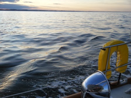
| This is what shore looks like from a few miles out. See any landmarks? |
A
boat left the marina Wednesday skippered by three tugboat captains, friends of
the new owner, from parts north of here. The owner was not aboard. An hour or so
downriver, they called Ashley, our dockmaster. The generator would not start
(as it had during sea trials), so they could not charge their cell phones.
Really, their cell phones.
Ashley
asked where they were planning to stop for the night, and they replied
Belhaven. Per Butch, our other dockmaster, the rest of the conversation went something like this.
“Where
are you currently?” Ashley inquired.
“We’re
still on the Neuse River.”
“Where
on the Neuse? Entrance to Bay River or Jones Bay?”
“Not
sure.”
“Well,
can you check your charts?” asked Ashley, the former navigator on a nuclear
submarine.
“We
don't have any charts,” replied whichever genius tugboat captain was holding a
cell phone with dying battery capacity at the time.
“Well,
you cannot make Belhaven before dark. It is almost 1700, and you are not yet in
Jones Bay. You are easily four hours or more from Belhaven.”
Of
course, they might have been near
Jones Bay, but they could not know because THEY DID NOT HAVE ANY CHARTS.
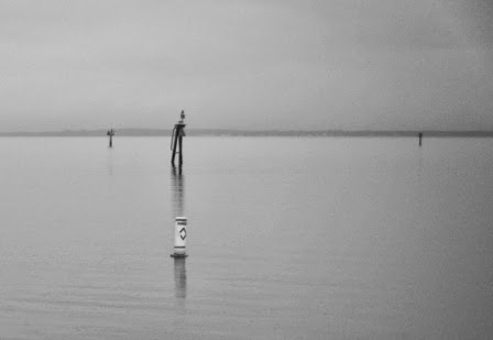 |
| Markers like these seen on a rainy morning are numerous along the ICW, but are useless without charts to translate where the markers are. These could be any bay in North Carolina or any other state for that matter. |
Perhaps
they thought the ICW is like any interstate highway with plenty of asphalt
roadway and directional signage. Sure, there are many channel markers along and
near the ICW and mile markers every five miles (though often set obscurely
distant near a far shore). And there are also hazards like shoals and special restricted
zones (read: military bombing ranges where mariners without charts get buzzed
by low-flying fighter jets until they understand that they are where they
should not be) in addition to channels leading up dead end tributaries and
private markers leading who knows where. There are no big green signs along the
waterway that read
EXIT HERE FOR JONES BAY,
HOBUCKEN AND PAMLICO RIVER.
All the
information is on the charts, just not presented the way a long-haul trucker
would recognize.
 |
| This is the shore from less than a quarter mile. Still not much in the way of landmarks. |
Some
of my students grew up on these waters, hunting, fishing and messing about in
boats. When we began to discuss geometry, I thought using a compass would be a
logical point of reference. Wrong. They say they do not ever use a compass,
only GPS. And what if the batteries die? They are certain that will not happen
to them in a fog or heavy rain surrounded by featureless marsh with no
landmarks in sight. I can only hope they are right.
 |
| A sea buoy off the coast. |
Modern
technology has made navigation much easier than prior to GPS. The
satellites that triangulate our locations are wonderfully accurate. Even some
seasoned and traditional mariners now argue that knowing how to navigate by
sun and stars is passé. With the passing of the sextant also go the chronometer and
the sight reduction tables. GPS tells all. When it works.
Nevertheless,
celestial navigation is a lovely art in its own right. The ability to hold the
sextant steady enough to hang the lip of the sun on the edge of the horizon
while the boat rolls and sways at sea, to mark GMT at the moment of connecting
with the horizon and then to perform the mathematical operations that
ultimately identify your boat’s place on the planet. Even greater than that mastery
of an ancient art is the connection with a seafaring tradition that reaches aft
for millennia, to the times of the quadrant, the astrolabe and even back to the cross staff.
Hail Atlantis! Myth, legend or undiscovered history, is it surprising that Plato would celebrate an advanced maritime society whose accomplishments surpassed his own culture’s? Humans embrace the search beyond the horizon, beyond the solar system, beyond the galaxy. Such yearning to explore, such dreaming of discovering unfound places, expresses the deep courage and hope that marks the best of our species.
Personally,
I celebrate our participation in the nautical tradition, albeit in a plastic
boat where wood is mere ornament. Much has changed, perhaps even improved, with
the advent of exotic materials. While knots have changed little if at all, the
lines into which we tie them are so highly engineered that a braided synthetic
of negligible weight can replace stainless steel cable as a lifeline or forestay just as extremely light
weight carbon fiber has replaced wood in hulls, masts and booms.
On
the local waterfront, TS Karen grows unpredictably in the Gulf with a wild array of
potential tracks over the next several days. We, as always, keep a weather eye.
No comments:
Post a Comment
Note: Only a member of this blog may post a comment.