Beware the power of words.
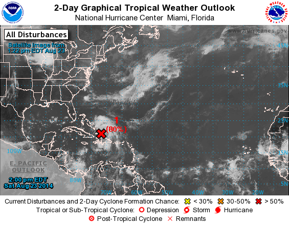
When I wrote last week's blog, I did not intend for the title to predict our next hurricane nor did I expect the caption under the NHC graphic to be a forecast of one. In fact, the little disturbance off the coast of Africa seemed an ideal example or illustration of the data we watch as it showed so little promise of developing; its odds a week ago were 0% within two days and 20% within five. Surely it would dissipate within a few days as its subsequent sibling did last week.
Stubbornly, the disorganized cluster of rain, wind and thunderstorms has hiked its way across the ocean, up through the Caribbean and has reached The Bahamas in a week's time. Just like a real tropical storm or hurricane would.
Today, still disorganized with no clear circulation, its odds are 80% for forming within two days and 90% within five. There are tropical storm force winds, and conditions are favorable for strengthening into a tropical depression or a tropical storm. Within a couple of days, it might finally organize into a tropical depression or tropical storm. Then, it is something to watch closely as it intensifies and develops real direction. For now, the forecast models vary widely, some spinning away from the coast, others steering over land. As is too often true, North Carolina sits squarely in the median of all possibilities.
Keep a weather eye. Always.
1945. NHC now classifies the disturbance as a tropical depression.
 2000. NHC names TD 4.
1945. NHC now classifies the disturbance as a tropical depression.
No comments:
Post a Comment
Note: Only a member of this blog may post a comment.